Live vessel tracking
Position, speed, heading, battery and movement state for every boat, updating as often as every ten seconds, on our own chart of the Maldives or satellite imagery.
Dhuveli follows every boat you run: where it is now, every trip it makes, and when it will arrive. Schedules, crew, fuel and documents live alongside, and the alerts reach your team on Telegram. Built in Maafushi for operators across the Maldives.
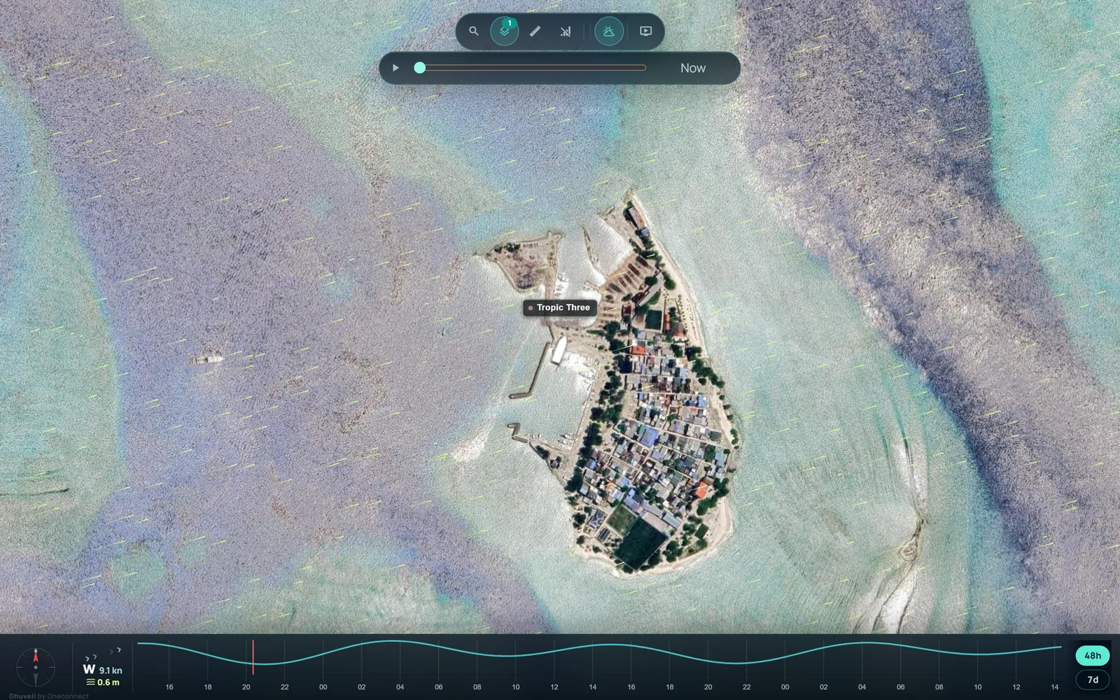
Operators on Dhuveli








Where each vessel is, how fast it is going and where it is heading, on our own chart of the Maldives or on satellite imagery, with the wind, the sea and the tide beside it. These are screenshots of the app as it runs today.
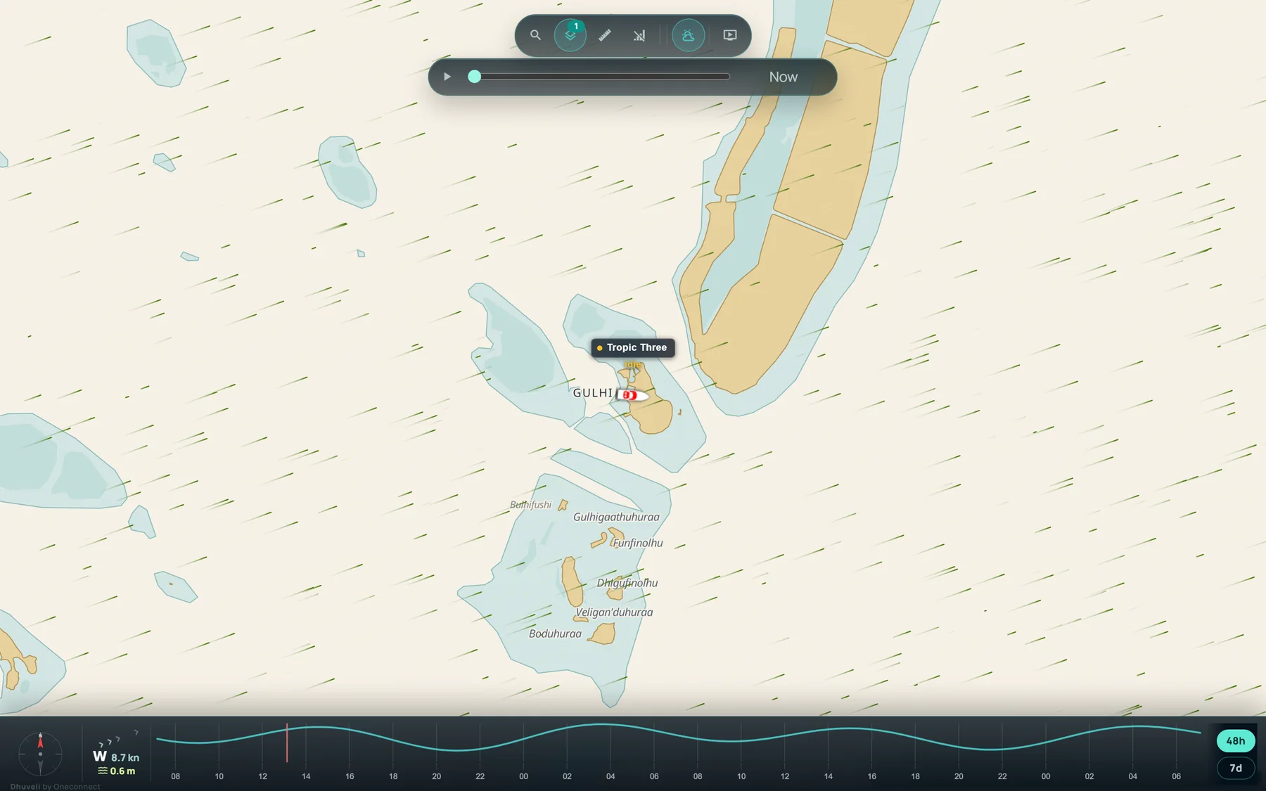
Drawn from the survey authority's islands, reefs and lagoons and kept current with new harbours and reclaimed land. Dhuveli Daylight for the day, Dhuveli Midnight for the wheelhouse at night, and Google or Mapbox satellite imagery one click away.
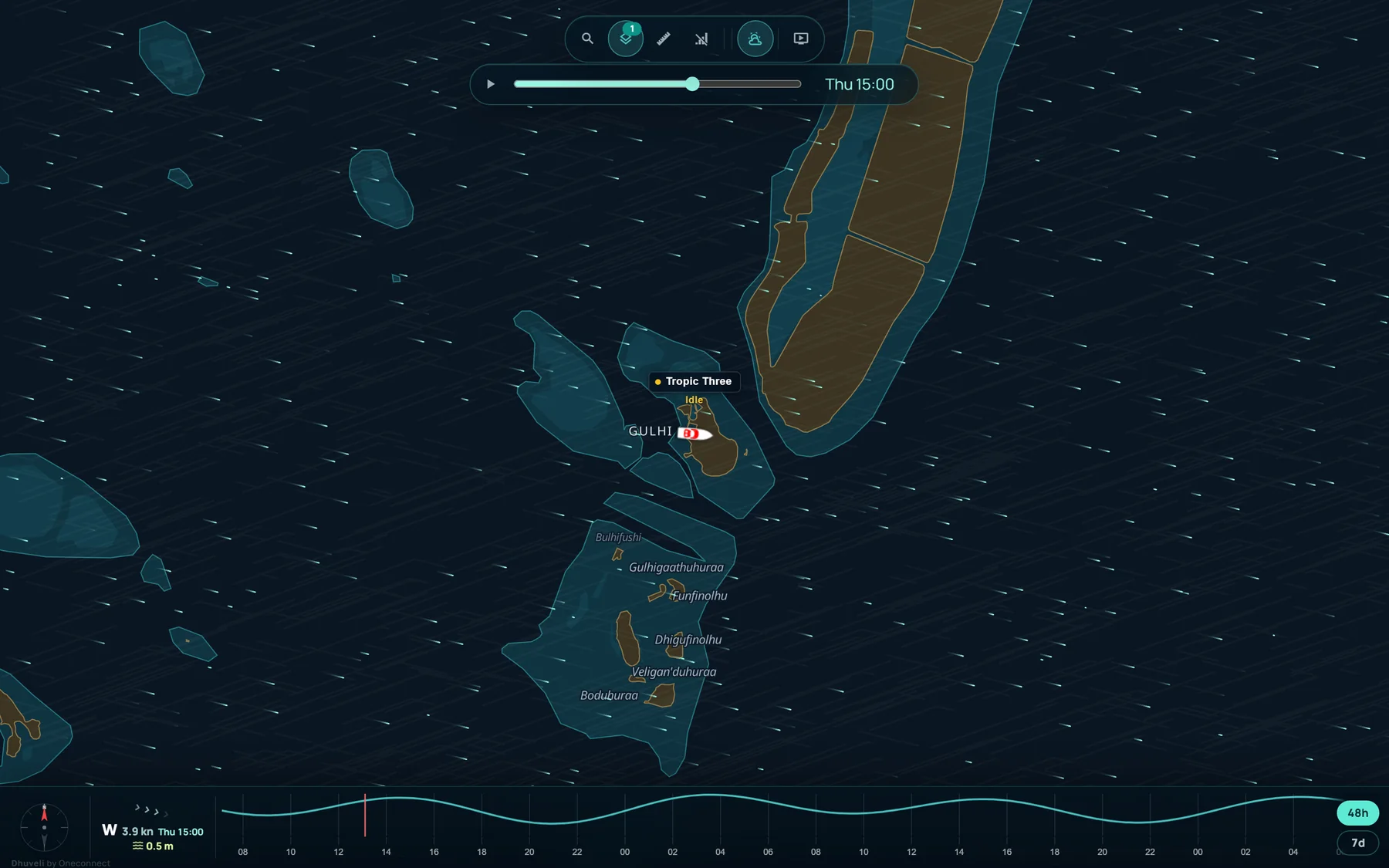
The forecast wind moves over the map as particles: direction as motion, strength as pace and colour. Drag the slider up to 48 hours ahead and the strip below shows the wind and sea for that hour, wherever the map is looking.
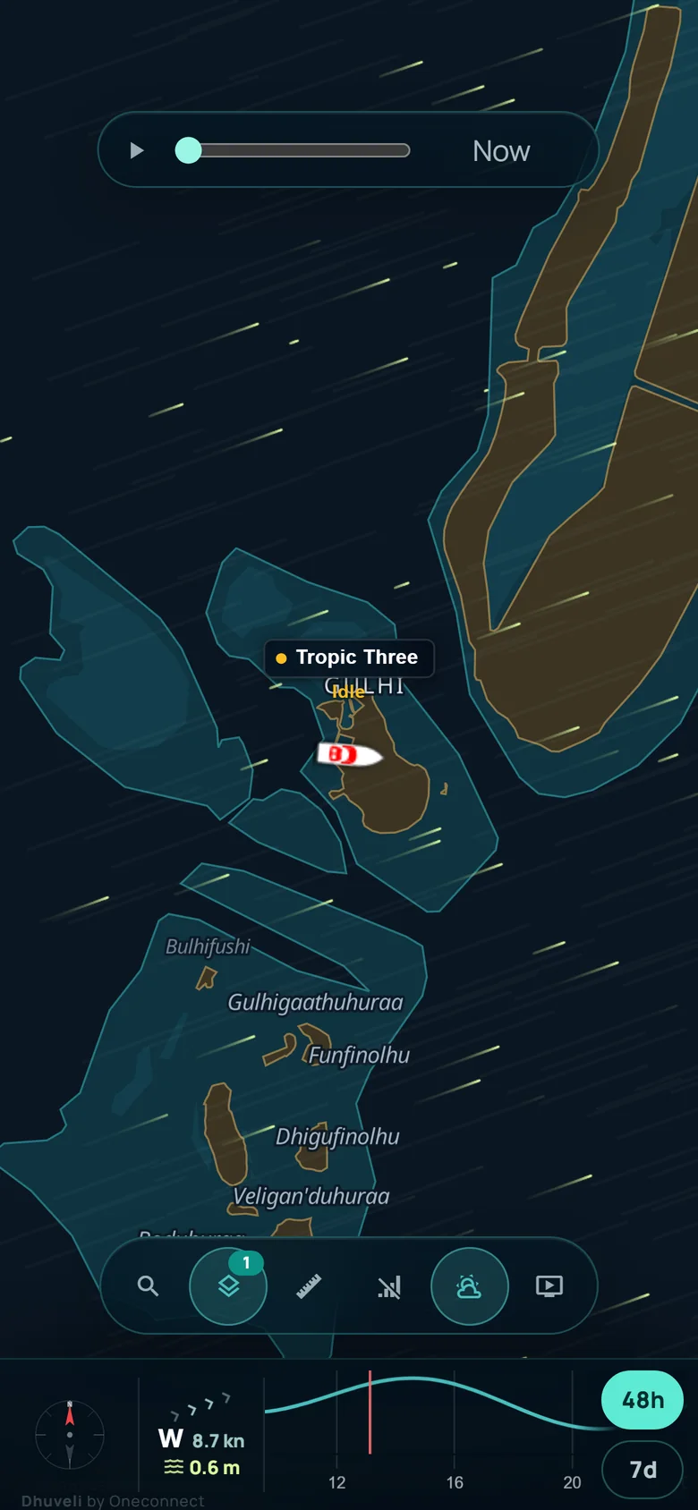
Send a live map of one vessel to a guest, an agent or a partner. It opens on any phone with no app and no login, shows the map, the weather and the tide, and can be switched off whenever you like.
Built for Maldivian boat operators, guesthouses and resorts — fast live GPS visibility, practical records, and useful automation, from real-time tracking to fuel, maintenance and document control.
Position, speed, heading, battery and movement state for every boat, updating as often as every ten seconds, on our own chart of the Maldives or satellite imagery.
Every voyage recorded as it happens: departure, stops, distance and speed. Replay any trip, see heatmaps, and export to CSV or PDF.
Arrivals, departures, arriving soon, overspeed, low battery and lost signal, plus a summary of each trip, sent to your Telegram group or to your own systems by webhook.
Plan trips with vessels, captains, crew and agents in one place, with passenger manifests, a daily schedule, and each departure checked against the trip that ran.
Log refuelling, track consumption per vessel, and run reusable maintenance and safety checklists on a schedule.
Every vessel document, permit and licence in one place, with reminders before anything lapses.
The latest additions: wind on the map; our own chart of the Maldives, by day as Dhuveli Daylight and by night as Dhuveli Midnight; a log of every trip that keeps itself; arrival times; and speed analysis.
The forecast wind as moving particles over the map, with a slider that runs 48 hours ahead in three-hour steps. The weather strip follows the hour you pick. On the live map and on shared links alike.
Our own chart of the Maldives, drawn from the survey authority's islands, reefs and lagoons, and kept current with new harbours and reclaimed land. By day, Dhuveli Daylight; by night, Dhuveli Midnight. Both are one click from the satellite imagery the map opens on.
Every voyage logged on its own: when and where it left, where it stopped, how far and how fast. Filter by vessel or captain, see scheduled departures against the trips that ran, and export to CSV or PDF.
Where each boat is heading and when it will get there, estimated from its own past voyages, with an alert to your group when it is nearly in.
Cruise speed, time in each speed band and every run over the limit, for each trip and each vessel, with a report ready to print.
When a boat arrives, one line on the trip in your Telegram group: where from, how long, how far, and any time over the speed limit. Switch it on per group.
Every island, atoll, harbour, dive site, wreck, FAD and navigation light, with tide times and live wind and sea for all 1,134 islands. Free, open, no sign-up.
A clean, token-secured REST API and an embeddable live map — connect Dhuveli to your booking system, resort dashboard, or your own app.
$ curl -H "Authorization: Bearer TOKEN" \
     https://dhuveli.com/api/v1/vessels/12/track

{
  "vessel": { "id": 12, "name": "Ocean Queen" },
  "positions": [
    { "lat": 3.9476, "lng": 73.4869,
      "speed": { "knots": 9.2, "kmh": 17.0 },
      "fixTime": "2026-06-17T16:34:18Z" }
  ],
  "events": [
    { "type": "deviceMoving", "time": "2026-06-17T16:30:02Z" }
  ]
}Every island, harbour, jetty, dive site, wreck, FAD, ice plant, navigation light and protected area in the country — with coordinates, Dhivehi names and the places around each one. Plus tide times for any island and live wind and sea by atoll. We built it because we needed it, and there is no reason to keep it to ourselves.
Sources credited on every page: the Maldives Land and Survey Authority, the Fisheries Information System, OpenStreetMap contributors and the EOT20 tide model. For planning, not for navigation.
Computed here, now, from harmonic constants — the same figures the atlas serves for all 1,134 islands. Maldives time, metres about mean sea level.
Dhuveli connects live device data with the routines your fleet team already runs every day.
Collect live GPS fixes from supported devices and display position, speed, heading, and power state.
Turn raw locations into route history, ETA context, geofence movement, and trip reports.
Use schedules, crew assignments, documents, and sharing links to keep people aligned.
Notify teams through Telegram and ensure the right people are informed at the right time.
Choose the level of history, update speed, sharing, and operational tooling your team needs.
Essential vessel tracking and alerts.
Faster updates, history and stronger reporting.
Full operational platform for fleet teams.
Prices in Maldivian Rufiyaa (Rf), billed annually. GPS devices & installation quoted separately.
Dhuveli supports thousands of tracker models and can supply practical hardware options for boats, tenders, and portable use cases.
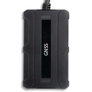
Cost-effective tracker with internal GPS/GSM antennas and optional Bluetooth connectivity. Ideal for small tenders and dinghies.
Rf 1,700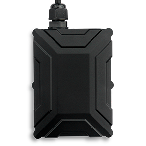
Supports 1-Wire accessories including temperature sensors and fuel level probes. Best for larger working vessels.
Rf 3,700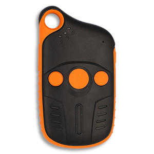
Long-standby portable tracker with a rugged, water-resistant design. Perfect for crew safety and portable operations.
Rf 4,700Whether you need a demo, a quote, or help with installation — reach out and we'll respond within one business day.
Opens WhatsApp with your message ready to send. Prefer email? info@oneconnect.mv
Dhuveli is ready for daily marine operations — from one public-facing vessel link to a full management console for growing fleets.